Vinland Voyage Map Generator
This form takes longitude/latitude pairs as input and plops them on
a Mercator projection map along with land/sea and political boundaries.
The map bounds will be about 10% larger than the bounds of the entered
data points.
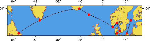
The default values on the form below yeild this nice map of a posible
voyage to Vinland .
The map is by "pscoast," part of the freely
available GMT package, version 3.
Pete did all the rest of the playing with this form for the map to
Vinland.
The URL of this page is http://crusty.er.usgs.gov/mapit/index.html
Last modified: Monday, 30-Aug-99 09:04:16 EDT
For comments and questions, contact rsignell (at) crusty.er.usgs.gov
Rich
Signell